Shimane 01_01 (heart / watercolor)

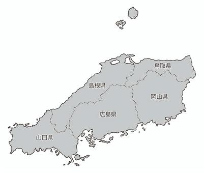
Japan region division _ China _ prefecture name entered _ gry

Ruriko-ji Five-storied Pagoda

Chugoku region Municipalities Yamaguchi Prefecture Boundary expansion

Map of Japan

1 slice of chestnut yokan (Kurimushi yokan)

Illustration of a company employee standing on a map of Tottori Prefecture

Illustration of a company employee standing on a map of Shimane Prefecture

Map of Japan Eight regional divisions with prefectural borders

Hagi's earthen wall

Chugoku region Prefectural border Japan map Place name

Chugoku Regional Expressway Japan Map Black and White

Shimane silhouette

Map of Japan_Region_Shadow

Minimal Japan map icon: black

Chestnut yokan separately


Chestnut yokan with yokan

Hinomaru

Okayama Prefecture

Okayama Prefecture

Yamaguchi City, Yamaguchi Prefecture Map

Hagi's old townscape

Fugu

Kaminoseki sea

Autumn in Chomonkyo

Yamaguchi Prefecture Yamaguchi City Prefectural Capital Boundary

Kuri Yokan

Izumo soba 1 3 layers and condiments

Chugoku Region Municipalities Okayama Prefecture Boundary Place Name

Chugoku region Municipalities Hiroshima Prefecture Boundary sea Place name

Tottori prefecture silhouette

chestnut yokan

Yamaguchi Prefecture

山口県白地図

yamaguchi prefecture shape color plate three dimensional

Japan

Tottori prefecture

simple map of japan

Hiroshima prefecture silhouette

Colored illustration of Japan map

Old townscape of Hagi

Hagi's old townscape

Akiho Port

map tottori prefecture

Summer in Kaminoseki

Tottori Prefecture Silhouette 2

All over Japan

Chomonkyo in late autumn

Japan_Chugoku region_Prefecture name / Prefectural office location_gry

Okayama Prefecture / Map / Handheld / Okayama / Travel

Tsunoshima, Yamaguchi Prefecture

Shepherd

Kagawa 01_01 (heart / watercolor)

Brush character Chugoku region

Deformed illustrations of the pop Japanese archipelago

Chugoku region map

Map of Okayama prefecture

Illustration of the Japanese archipelago divided by region

栗羊羹③

Chugoku region silhouette

Kuri Yokan

栗羊羹

Yamaguchi Prefecture Prefectural Boundary Contour Shape

Yamaguchi Prefecture

Shimane Prefecture Silhouette 2

Hagi's old townscape

Shimane Prefecture, Map, SHIMANE, Tourism

Blank map of Tottori prefecture

栗羊羹

Map-Tottori Prefecture

From Okayama Prefecture

Freehand drawn and shaded Yamaguchi prefecture

Map of Japan_47 prefectures_shadow

Yamaguchi Map

Weather forecast/caster woman

Sanin Shiba Inu

Crocodile Stone Bridge

Chugoku region Prefectural border Japan map Color Place name

Hiroshima Prefecture Silhouette 2

Hiroshima silhouette

A small fishing port in the Sanin region

Hagi's old townscape

Satoyama early summer

Cityscape in early summer

Okayama, map, OKAYAMA, Okayama prefecture, sightseeing

Shimane Prefecture

A relaxed map of Shimane Prefecture (without Oki)

A relaxed map of Shimane Prefecture

Hiroshima prefecture _ frame

Japanese-style map of Chugoku region Map of Japan

山口県地図

栗ようかん

Kuri Yokan

Yamaguchi Prefecture Prefectural Boundary Contour Shape

Yamaguchi Prefecture Silhouette

Yamaguchi Prefecture Tamaso Shrine Temple Shrine Visit

Old townscape

Hiroshima

simple map of japan
1706 clip art vectoriel gratuit sur .
Besoin d'un clip art vectoriel ? Trouvez les meilleures images gratuites sur .
Tout le clip art vectoriel est gratuit même pour les projets commerciaux.

 © 2011 - 2025 ACworks Co.,Ltd. All rights reserved.


